RESEARCH PLATFORMS
Wulanaodu Station
The Wulan'aodu Desertification Combating Research Station, Institute of Applied Ecology, Chinese Academy of Sciences (Wulan'aodu Station) was established in 1975. From 2000 to 2021, the Wulan'aodu Station was successively selected into the National Desertification Monitoring Network, Ground-based Sandstorm Monitoring Station of the National Forestry and Grassland Administration, and Wind Erosion Observation Station for National Soil and Water Conservation Monitoring Network, Minsistry of Water Resources. In 2025, it became a core research base of the Inner Mongolia Academician Workstation for Protective Forest Program and Desertification Control.
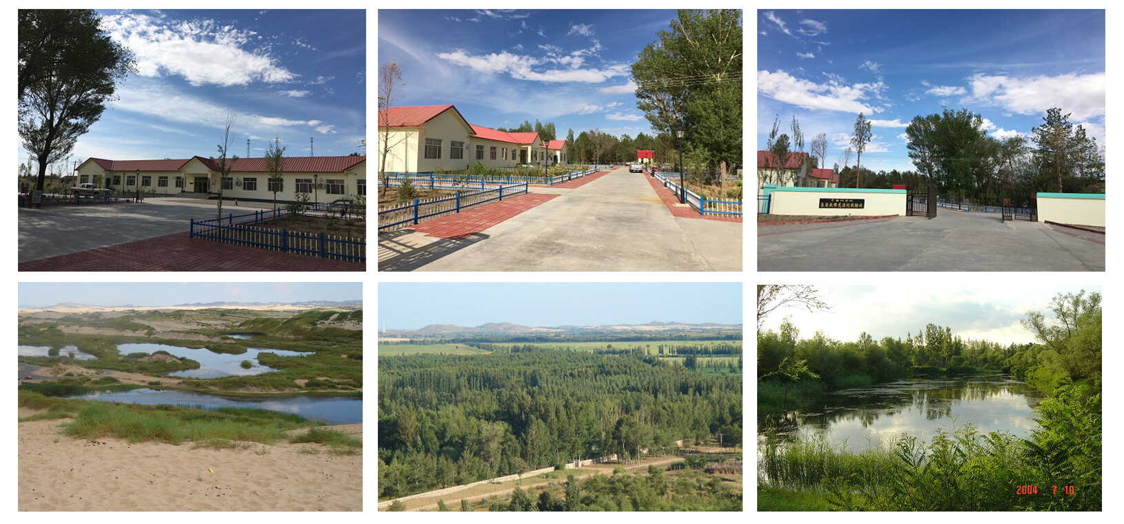
The Wulan'aodu Station is located in Wulan'aodu Village (119°38′E, 43°02′N, 479 m above sea level), Wengniute County, Chifeng City, Inner Mongolia Autonomous Region. It is situated in the western part of the Horqin Sandy Land, which belongs to the Critical Zone of Quaternary alluvial-lacustrine-aeolian plains. Furthermore, the Wulan'aodu Station is located in the core area of the “Northern Sand Prevention Belt” in the “Three Eco-zones and Four Shelterbelts” Ecological Security Strategic Pattern, and also serves as the main battleground of the “Horqin-Otingdag Sandy Land Eradication Battle” for the Crucial Stage in the Three-North Shelter Forest Program (TNSFP). The climate type is classified as a northern temperate semi-arid monsoon climate, with an average annual temperature of 6.2 °C, precipitation of 340 mm, evaporation of 2230 mm, and wind speed of 4.2 m s-1. Moderate to Fresh Gale (Beaufort Scale Forces 7–8) frequently occur during the spring sandstorm-prone period. The soil types include four categories widely distributed in the Horqin Sandy Land: aeolian sandy soil, meadow soil, saline-alkali soil, and chestnut soil. The vegetation represents a transitional type from the Eurasian steppe to the Northeast Asia mixed coniferous-broadleaf forest. The zonal climax vegetation is Sparse Forest Steppe (Horqin Steppe), and the original native vegetation has virtually vanished, replaced by secondary sandy vegetation at different successional stages. Major landform types such as sandy land, mountainous land, meadow land, and interdune lowlands are distributed in a mosaic pattern, forming the unique “sandy land ecosystem” with alternating dunes and meadows in the Horqin Sandy Land (including the compound ecosystem of “mountains, rivers, forests, farmlands, lakes, and grasslands” embedded in the sandy land).
The Wulan'aodu station occupies an area of 60,000 m² and possesses the land use right for 10,000 m² of state-owned construction land. The station has research and living facilities including comprehensive research buildings, mobile personnel apartments, laboratories, a cafeteria, warehouses, and pump houses, as well as auxiliary research spaces such as meeting rooms, activity rooms, reference rooms, and a station history gallery. The total floor area of all buildings is 1,200 m², and the entire station area is equipped with comprehensive gigabit fiber optic network coverage. There is a sandy land botanical garden (i.e., long-term experimental base of sandy land vegetation artificial restoration) with area of 25 hm2, two automatic weather observation fields, one automatic sandstorm observation platform, and three wind erosion observation sites. Additionally, it has set up over 40 permanent monitoring plots for the observation of water, soil, atmosphere, and organisms in typical sandy land ecosystems. The station is equipped with more than 50 conventional laboratory instruments, over 30 sets of field sandstorm environment monitoring equipment, and more than 20 instruments for measuring plant physiological and ecological parameters.
The Wulan'aodu station addresses national strategic needs, such as strengthening the ecological security barrier in northern China and the “Horqin-Otingdag Sandy Land Eradication Battle” of the TNSFP. Following the Critical Zone of the Horqin Sandy Land and centering on ecosystem functions and services as well as wind-field/regional sustainable development, we focus on four topics: 1) the formation and evolution mechanisms of multiple spheres in the critical zone of the Horqin Sandy Land, 2) the coupling mechanisms of hydrological and biogeochemical cycles in sandy land systems, 3) the function restoration technologies for the critical zone under the dual drivers of global change and human activities, and 4) the collaborative governance of composite ecosystems and pathways for regional sustainable development. Taking root in the Horqin Sandy Land, oriented to the Three-North Region and aiming at the international scope, the Wulan'aodu station aims to establish a core science and technology think tank, promote the development of disciplines such as critical zone science and ecology, and develop an integrated and world-class field experiment platform.